We use cookies to make your experience better. To comply with the new e-Privacy directive, we need to ask for your consent to set the cookies.
Toggle Nav

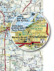
Road Atlases


Categories
-
Trail Maps ( 433 )
- Trails Illustrated Maps ( 416 )
- National Parks ( 139 )
- Appalachian Trail ( 21 )
- Pacific Crest Trail ( 19 )
- Alaska ( 13 )
- Arizona ( 23 )
- Arkansas ( 3 )
- California ( 55 )
- Canada: Alberta - British Columbia ( 12 )
- Colorado ( 79 )
- Connecticut ( 3 )
- Delaware ( 1 )
- Florida ( 3 )
- Georgia ( 7 )
- Hawaii ( 2 )
- Idaho ( 17 )
- Indiana ( 1 )
- Kentucky ( 3 )
- Maine ( 13 )
- Maryland ( 4 )
- Massachusetts ( 5 )
- Michigan ( 5 )
- Minnesota ( 6 )
- Missouri ( 2 )
- Montana ( 23 )
- Nevada ( 10 )
- New Hampshire ( 6 )
- New Jersey ( 4 )
- New Mexico ( 5 )
- New York ( 14 )
- North Carolina ( 19 )
- North Dakota ( 1 )
- Oregon ( 11 )
- Pennsylvania ( 8 )
- Puerto Rico & Virgin Islands ( 2 )
- South Carolina ( 2 )
- South Dakota ( 5 )
- Tennessee ( 15 )
- Texas ( 5 )
- Utah ( 39 )
- Vermont ( 7 )
- Virginia ( 20 )
- Washington ( 19 )
- West Virginia ( 9 )
- Wisconsin ( 1 )
- Wyoming ( 21 )
- Europe ( 7 )
- Topographic Map Guides ( 96 )
- National Parks ( 29 )
- Appalachian Trail ( 20 )
- Pacific Crest Trail ( 18 )
- Arizona ( 2 )
- California ( 17 )
- Colorado ( 21 )
- Connecticut ( 3 )
- Georgia ( 3 )
- Idaho ( 2 )
- Maine ( 6 )
- Maryland ( 3 )
- Massachusetts ( 3 )
- Montana ( 4 )
- Nevada ( 3 )
- New Hampshire ( 3 )
- New Jersey ( 3 )
- New York ( 3 )
- North Carolina ( 6 )
- Oregon ( 4 )
- Pennsylvania ( 4 )
- South Dakota ( 1 )
- Tennessee ( 6 )
- Texas ( 2 )
- Utah ( 4 )
- Vermont ( 3 )
- Virginia ( 7 )
- Washington ( 7 )
- West Virginia ( 3 )
- Canada: Alberta - British Columbia ( 2 )
- Europe ( 8 )
- Day Hikes ( 29 )
- Great Treks ( 56 )
- Reference Maps ( 2 )
- Trails Illustrated Maps ( 416 )
- Travel Maps ( 230 )
-
Wall Maps ( 801 )
- Reference Maps ( 239 )
- World ( 54 )
- United States ( 32 )
- USA Regions ( 40 )
- Continents ( 34 )
- Africa ( 12 )
- Arctic ( 2 )
- Asia ( 27 )
- Australia & Oceania ( 8 )
- Europe ( 33 )
- North America ( 23 )
- South America ( 7 )
- Oceans ( 4 )
- History & Science ( 28 )
- National Parks ( 6 )
- Space ( 13 )
- Kids ( 12 )
- Pacific Crest Trail ( 0 )
- Kids ( 12 )
- Map Archive ( 562 )
- Trails Illustrated Maps ( 0 )
- Great Treks ( 0 )
- Reference Maps ( 239 )
- Books & Atlases ( 53 )