We use cookies to make your experience better. To comply with the new e-Privacy directive, we need to ask for your consent to set the cookies.
Toggle Nav

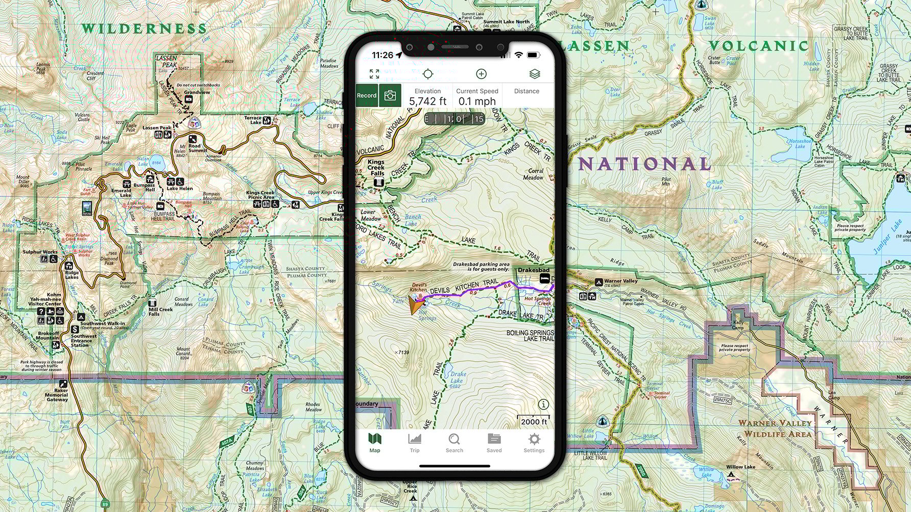
![]() MAP + APP - Experienced modern outdoorspeople know that the combination of map plus app provides the safest and most efficient way to navigate the outdoors, whether searching for their next hike or backcountry adventure, or deep in the wilderness trying to find their way to a natural feature or facility or back to their vehicle.
MAP + APP - Experienced modern outdoorspeople know that the combination of map plus app provides the safest and most efficient way to navigate the outdoors, whether searching for their next hike or backcountry adventure, or deep in the wilderness trying to find their way to a natural feature or facility or back to their vehicle.
Paper maps provide context to trails and local areas, showing the big picture with surrounding towns and points of interest, making them the best tool for scoping and planning routes and discovering features to explore. Plus, they never fail due to cold, heat, or water, or lack of battery life or connectivity, making them an essential backup for backcountry adventures.
Digital map apps are great for searching large collections of trails and features by name, showing where you are on the map, or calculating distance, direction, and elevation gain. Of course, it matters which map an app is using, and it's best for the digital and print maps to match up for seamless transition from paper to digital navigation.
Download our seamless Trails Illustrated maps and Topographic Map Guides to your mobile device with Gaia GPS. Use Gaia GPS to download offline maps, plan and record trips, and navigate out in the wild.
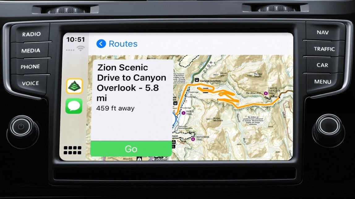
With Gaia GPS CarPlay integration for iOS, Trails Illustrated maps can help iPhone users get to the trailhead and navigate backcountry roads and trails in your vehicle's built-in navigation console.
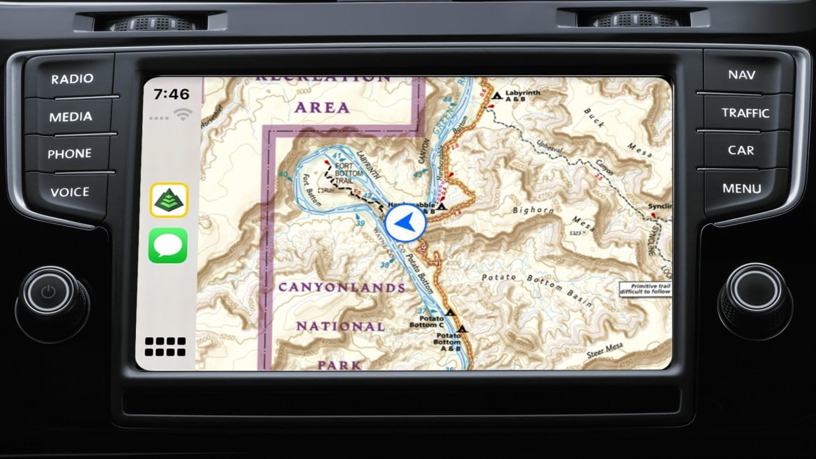
Gaia GPS on CarPlay provides turn-by-turn directions on the way to the trailhead and while you're on the backcountry 4x4 trails.
Join hundreds of thousands of backpackers, hunters, offroaders, mountain bikers, backcountry skiers, firefighters, guides, and other serious outdoor adventurers and professionals that use Gaia GPS for work and play.
With a Premium Membership in Gaia GPS, you get access to hundreds of Trails Illustrated titles, to use out in the field. Download the free app below:
iPhone/iPad - Hiking Maps + Hiking App |
Android Phones/Tablets - Hiking Maps + Hiking App |
You can also use gaiagps.com to browse hiking trips, or plan hiking trips and print topo maps for backup.
Avenza Maps
Our outdoor recreation, travel, reference, and historical maps are available through the Avenza Maps store to download and track your location within the Avenza Maps mobile app.
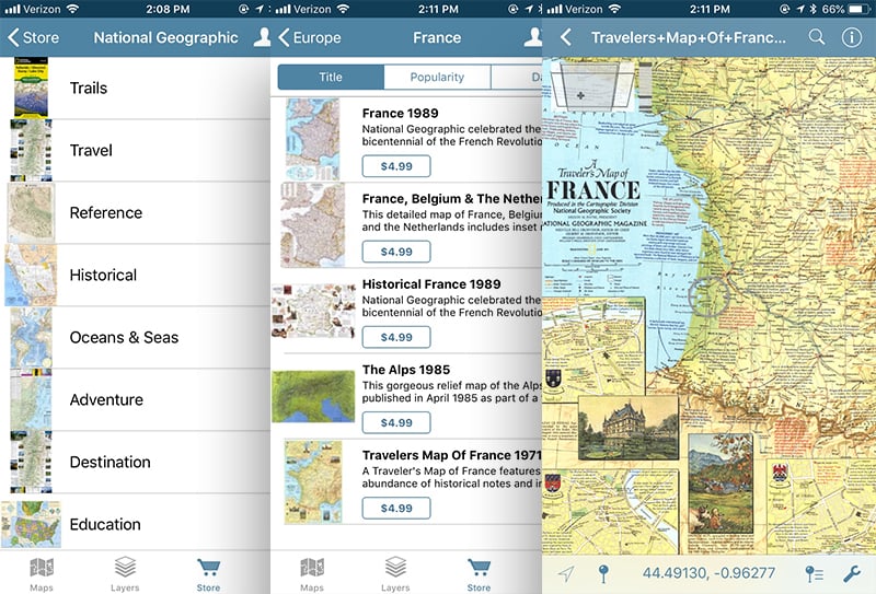
Each map is purchased separately, letting you build your personal NatGeo map collection on your mobile device.
Licensing
We license our digital maps to other organizations to use in their products and publications. From our Africa map printed in 1909, to our latest reference, adventure, or trail maps, National Geographic’s unique, vast map archive is available to be licensed for print or digital products. We offer maps to suit any number of needs and tastes, from a historic map of New York City to showcase in a home décor catalog, to a map of the US Civil War for a textbook, or a Trails Illustrated map for natural resource management. Learn more about licensing our maps and data.